

Severe storms, tornadoes moved through Oklahoma
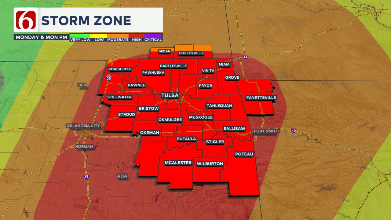
Strong winds, hail, rain and tornadoes are all in the forecast. The News On 6 weather team is keeping up with the latest forecasts and storm tracks. Follow along here for SEVERE WEATHER UPDATES all evening long for May 19, 2025.Monday, May 19th 2025, 7:47 pm
TULSA, Okla. -
Severe storms and hail moved through Green Country on Monday evening, and several confirmed tornadoes came through.
As of 3 a.m., there are no longer any active watches or warnings in Eastern Oklahoma.
Related: Heavy rain limits visibility around Downtown Tulsa: 'It is torrential!'
DAILY WEATHER STORY HERE. | For severe weather alerts, CLICK HERE.

The Oklahoma Department of Emergency Management reported the following damage as of 9:45 p.m. Monday:
Mayes County Emergency Management reports a few buildings are damaged in the industrial park in Locust Grove and Highway 69 is blocked by downed powerlines.
Muskogee County Emergency Management reports businesses and homes with roof damage in downtown Ft. Gibson. Trees are down from downtown to 6 Mile Road.
Okfuskee County Emergency Management reports two buildings damaged in Okemah and numerous tree limbs down.
Pittsburg County Emergency Management reports 10 homes destroyed in the Blanco and Pittsburg areas. Blanco fire department is destroyed.
Pontotoc County Emergency Management reports damage including tree limbs down, power lines down, and two carports destroyed. Many roadways experienced flash flooding.
Le Flore County Emergency Management and Choctaw Nation Emergency Management are assisting in Latimer County.
Oklahoma Highway Patrol reports all campers are accounted for at Robbers Cave State Park.
Damage assessments are ongoing in the counties listed above as well as in Adair, Cherokee, and Coal counties.
People can report damage at damage.ok.gov.
Timeline:
10:45 p.m.: Main line of severe storms has moved out of Oklahoma BUT additional storm development is possible across southeastern OK tonight. One storm near Ada trying to start. This next round may pulse severe and could last until 1 AM before moving out of state. More likely storm zone would be I-40 south with a lesser chance north up to I-44.
8:10 p.m.: For the first time in a while, there are NO more active Tornado Warnings in eastern Oklahoma! Storm development has struggled in areas northwest of Tulsa and storm chances may be starting to decrease there. But we do think there is another potential line of severe storms on the way later tonight that could move from southern Oklahoma back into parts of eastern and southeastern Oklahoma. We’ll be watching closely to see if that develops!
7:30 p.m.: Tornado Warning in Le Flore County with a small tornado confirmed very near Panama moving NE. This tornado may dissipate quickly, but take your tornado precautions around Panama!
7:15 p.m.: We have a confirmed tornado in Washington County, AR. The rest of the storms are still severe warned, but no other active tornado warnings in the viewing area.
7:00 p.m.: Two areas of circulations and possible tornadoes continue tracking NE in Adair County: One moving into Stilwell and another tracking toward Peavine and Westville. Continue to take your tornado precautions!
6:49 p.m.: Confirmed tornado just east of Lake Tenkiller and just south of Dry Creek moving NE into southern Adair County. This is tracking towards Lyons Switch and eventually Stilwell. TAKE COVER NOW!
6:39 p.m.: Still a strong sign of a tornado over Wilburton right now. Please continue to take shelter! This rotation will track toward Red Oak and the community of McCurtain.
6:32 p.m.: Confirmed tornado very near Gore in Sequoyah County tracking ENE toward portions of Lake Tenkiller. TAKE COVER NOW!
6:22 p.m.: A tornado continues in the Hartshorne area! This will track right towards Wilburton in the next few minutes. TAKE COVER NOW!
6:20 p.m.
Mena Becerra sent News On 6 this video of hail hitting her car in Tulsa near Pine and Harvard.
6:15 p.m.: Tornado Warning from eastern Mayes County into western Delaware County. A tornado is possible east of Locust Grove tracking toward Eucha and Jay. Even if a tornado doesn’t occur, damaging 70 mph winds are possible. Take shelter!
6:06 p.m.: Confirmed tornado continues in Pittsburg County just SE of McAlester tracking northeast. It’s rain-wrapped, you won’t be able to see it! Hartshorne, TAKE COVER NOW!
5:55 p.m.: CONFIRMED large tornado headed right toward Blanco in southern Pittsburg County. The blue circle in the bottom panel is radar indicating debris lofted into the air. From Blanco to Alderson to Hartshorne: TAKE COVER NOW!
5:46 p.m.: Looks like a tornado just crossed US-69 just south of Kiowa in southern Pittsburg County. Tracking toward Kiowa & Blanco!
Play the video below to watch coverage from News On 6 Storm Tracker Sequoya Quinton.
WATCH: Tornado in Pittsburg County, Oklahoma caught on camera
5:39 pm.: Tornado Warning in southern Pittsburg County. A confirmed tornado was near Wardville heading northeast toward Kiowa and Savanna. This could eventually track toward McAlester as well. Take cover now!!
5:25 p.m.: Tornado is trying to redevelop in Adair County near Christie heading toward Going Snake. Take cover from Going Snake to Chance, Westville, and Watts!
5:15 pm.: A brief tornado very well may have spun up over or *just* northeast of Tahlequah towards Briggs. Velocity has weakened a bit, but a tornado still possible northeast of Eldon heading quickly NE into Adair County. Take shelter across northern Adair County!
4:56 p.m.: Tornado Warning NOW for Tahlequah. Possible tornado is moving right over the city. Take cover Even if there isn’t a tornado, damaging winds up to 80 mph could occur.
4:42 p.m.: Damaging 60+ mph winds moving quickly from Fort Gibson to Tahlequah, and there’s some concern about rotating trying to increase here as we look at the velocities. Need to watch this one closely. Take proper shelter from the wind across Cherokee County!
4:25 p.m.: Severe storms moving northeast of Tulsa and from Muskogee to Tahlequah will pack quite a punch with damaging 60-70 mph wind gusts and cores of large hail.Tornado threats remain limited at the moment, but that could change soon so we’re watching very closely.
4:00 p.m.: Very stormy all across the Tulsa metro as multiple severe storms expand and move quickly NE. Hail up to golf ball size remains possible along with bursts of damaging 60 mph winds. Also a ton of rain in a short amount of time. Another severe storm cluster with hail and very strong winds is moving across McIntosh County into Muskogee County.
3:35 p.m.: Damaging golf ball size hail is still possible as this severe storm in Okmulgee County moves rapidly NNE into the Tulsa metro. Get the cars in the garage!
3:15 p.m.: Severe T-Storm Warning across Okfuskee County near Okemah. Big hail larger than golf ball size is possible as that moves north-northeast into Okmulgee County. Would be an impact for the Tulsa metro by 4 PM if it holds together.
2:50 p.m.: A Tornado Warning is in effect in Hughes County just west of our viewing area. A likely tornado is ongoing near the town of Allen. If this holds together, it would approach western McIntosh County and/or southern Okfuskee County by 3:30pm or earlier. Be prepared in these areas!
1:55 p.m.: Severe storms stretching from Nowata to Adair are moving quickly northeast. Large hail and damaging 60 mph winds are the primary threats right now. We're keeping a close eye on more storms developing west of Tulsa. Severe threats could increase as those storms move into northeastern Oklahoma.
Early Afternoon (1 p.m. – 5 p.m)
- First round of storms possible along and east of I-35, ahead of the dryline.
- Storms may become severe quickly.
- These storms would expand quickly across eastern Oklahoma from about 1 to 3 p.m. and will rapidly become severe with all modes of severe weather possible. Severe storms could be a big impact for kids coming home from school this afternoon, so plan ahead and be aware. This first round will continue up to the 5 PM rush hour drive.
Late Afternoon to Late Evening (5 p.m. – Midnight)
- The second wave of storms is expected to develop along the dryline, moving into central Oklahoma.
- Increasing instability and energy from a warm front will enhance the severe weather risk.
- Around 5 to 6 p.m. as the first round of severe storms continues across far eastern/southeastern Oklahoma, another round of severe storms looks likely to fire up along the dryline in central Oklahoma and then move back into eastern Oklahoma. Once again, these evening storms look to be intense with very large hail, damaging winds, and tornadoes all possible through the 10 PM hour.
- After 10 to 11 p.m., our biggest rounds of severe weather should be exiting further east toward Arkansas. One more round of scattered strong to severe storms with hail and wind threats will be possible from about 11 PM through the overnight hours as the cold front arrives. Once that cold front surges through Tuesday morning, our storm threats will come to an end.
Overnight (Midnight – 3 a.m.)
- Final round of storms likely as a surface cold front moves through the region.
- Severe weather remains possible.

CLOSURES IN TULSA:
- All Tulsa Parks Community Centers, including Oxley Nature Center, close at 4 p.m.
- Tulsa Animal Services - Closes at 4 p.m.
- Tulsa Zoo - Closes at 2 p.m.
- Tulsa Mulch Site - Closes at 3:30 p.m.
Key Hazards Throughout the Day
- Very large hail
- Damaging winds
- Tornadoes
Emergency Info: Outages Across Oklahoma:
Northeast Oklahoma has various power companies and electric cooperatives, many of which have overlapping areas of coverage. Below is a link to various outage maps.
- PSO Outage Map
- OG&E Outage Map
- VVEC Outage Map
- Indian Electric Cooperative (IEC) Outage Map
- Oklahoma Association of Electric Cooperatives Outage Map — (Note: Several Smaller Co-ops Included)
Follow the News On 6 Meteorologists on Facebook!
Here's a behind-the-scenes look at how we keep you informed and safe.
- Meteorologist Travis Meyer
- Meteorologist Stacia Knight
- Meteorologist Alan Crone
- Meteorologist Stephen Nehrenz
- Meteorologist Aaron Reeves
- Meteorologist Chloe Arroyo
Need-to-know severe Oklahoma weather prep:
🔗Severe weather safety: what you need to know to prepare
🔗Tornado Watch vs. Tornado Warning: what they mean and what to do
🔗Severe weather safety: what to do before, during, and after a storm
🔗Why registering your storm shelter in Oklahoma could save your life
🔗Floodwater kills more Oklahomans than tornadoes in the last decade, here's why
🔗'Turn around, don't drown': Flood safety tips for Oklahomans
🔗5 things to know: How Oklahomans can get federal money to install storm shelters
🔗Breaking down the SoonerSafe Rebate Program: Do I qualify for a storm shelter?
Watch us on YouTube!
Follow NewsOn6 on X/Twitter for automated severe weather alert posts >>>>>> @NewsOn6

Get The Daily Update!
Be among the first to get breaking news, weather, and general news updates from News on 6 delivered right to your inbox!
More Like This

May 19th, 2025

June 16th, 2025

June 7th, 2025

Top Headlines

June 16th, 2025


June 16th, 2025
