EF-1 tornado touches down in Collinsville Tuesday morning
A low-end EF-1 tornado touched down in Collinsville Tuesday morning and damaging winds battered parts of Green Country as well. Meteorologist Stephen Nehrenz has details.Tuesday, April 29th 2025, 5:46 pm
TULSA, Okla. -
Severe storms rolled through Green Country early Tuesday morning, and meteorologists say it's likely a brief tornado touched down in the Collinsville area just after 7 a.m., causing damage alongside widespread 70 mph winds.
Was there a tornado in Collinsville on Tuesday?
The National Weather Service reported Tuesday evening just after 5 p.m. that a "low-end" EF-1 tornado "uprooted several trees, destroyed, a couple outbuildings, damaged the roofs of homes, and snapped numerous large tree limbs."
The NWS said this was at 7:06 a.m. near 36.33N and 95.87W.
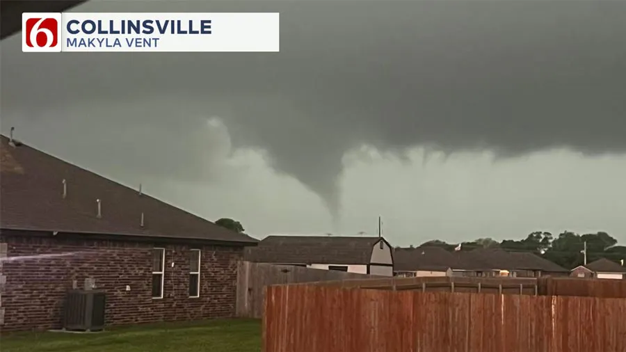
News On 6 Meteorologist Stephen Nehrenz said radar data and photos suggest a brief spin-up tornado developed as storms swept through Owasso and into Collinsville.
“You can see it very clearly,” Nehrenz said, pointing to a funnel cloud photo from MaKyla Vent. “This was just after 7 o'clock this morning, right into Collinsville. More than likely it didn’t last more than a minute or two.”
 Image Provided By: Makyla Vent
Another viewer, Stephanie, captured a similar funnel from Highway 169 near 116th Street North.
These quick spin-up tornadoes, often on the leading edge of a squall line, can develop and disappear in just minutes, sometimes without sufficient warning.
Radar confirmed signs of rotation
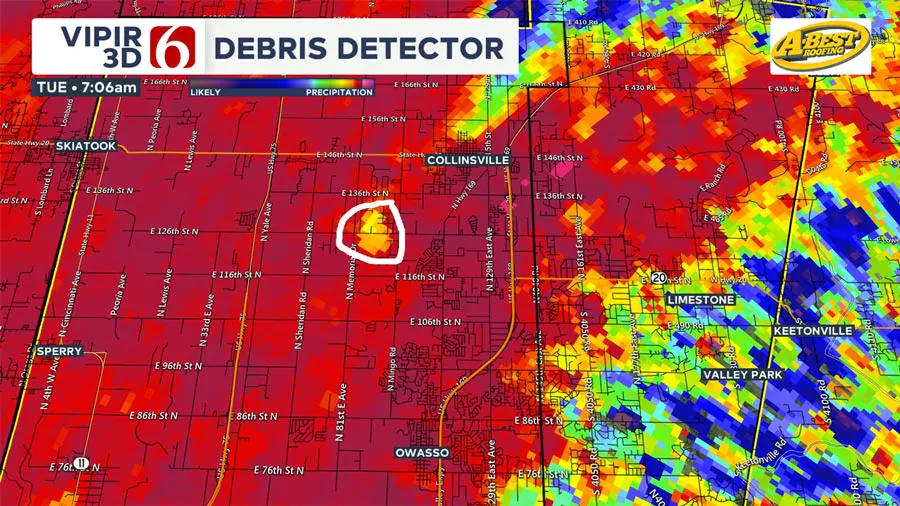
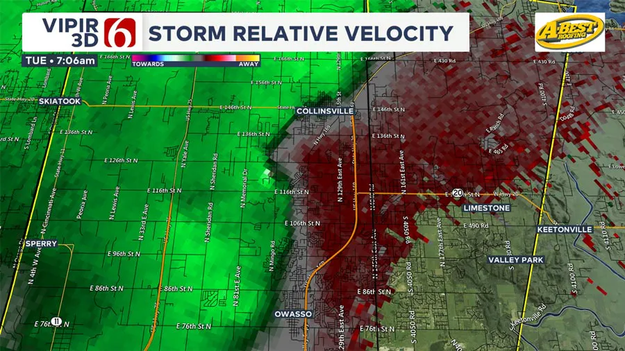
Nehrenz explained that radar products used to detect non-rain particles (often debris) showed a brief signal indicating likely rotation near Collinsville at 7:06 a.m.
 Image Provided By: Griffin Media
“That was right where there was just enough rotation to produce that likely tornado,” Nehrenz said. “Then it quickly transitioned back to damaging wind potential.”
 Image Provided By: Griffin Media
Damaging winds hit hard across the region
Even outside of the tornado threat, straight-line winds exceeding 70 mph caused widespread damage in parts of the Tulsa metro and northeast Oklahoma. The line of storms hit Owasso, Collinsville, Grove, and Jay as it moved east Tuesday morning.
More severe weather could be on the way
Meteorologist Stephen Nehrenz said more rain, flooding, and severe weather could hit Green Country again soon.
The National Weather Service in Tulsa is surveying damaged areas and will release official tornado confirmations after their assessments.
More Like This
April 29th, 2025
April 29th, 2025
April 29th, 2025
April 28th, 2025
Top Headlines
April 30th, 2025
April 29th, 2025


