Hurricane Erin Rapidly Intensifies into a Category 4
Hurricane Erin, the first hurricane of the 2025 Atlantic season, is forecast to strengthen and pass near the northern Leeward Islands this weekend.Friday, August 15th 2025, 10:45 am
Latest Advisory from the NHC
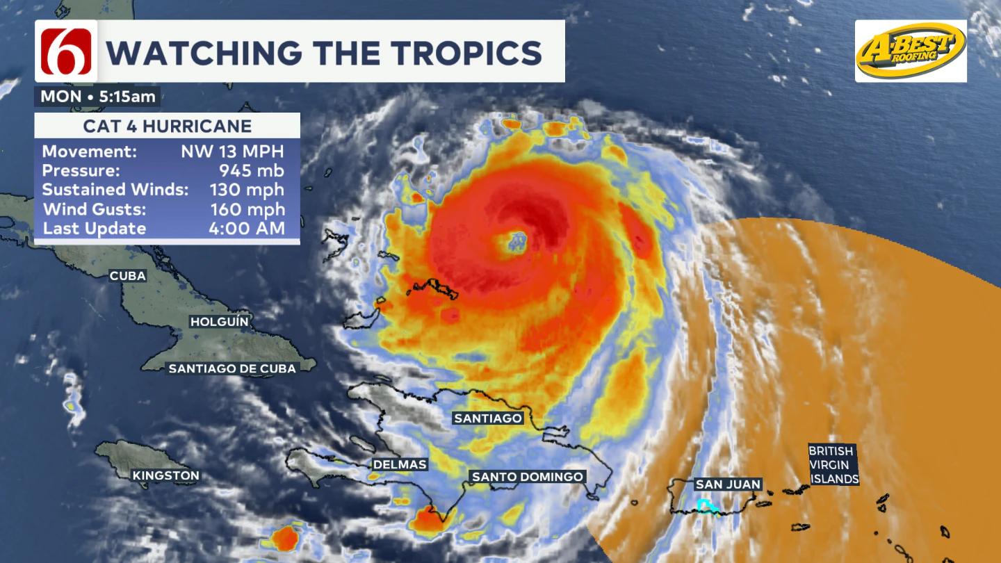
In the 4:00 AM Advisory issued by the National Hurricane Center, Hurricane Erin is currently a category 4 hurricane, with sustained winds of 130 MPH and gusts up to 160 MPH. As of 4:00 AM this morning, the eye of the storm is located about 105 miles NNE of Grand Turk Island, moving NW at 13 MPH, with a radius of nearly 80 miles away from the center.

Eyewall Replacement Cycle: What is it?
An eyewall replacement cycle occurs when an intense hurricane develops a secondary eyewall located outside of the primary, and temporarily takes over the initial eyewall until it re-intensifies.
On Sunday, Hurricane Erin went through this process, strengthening the storm back up to a category 4. At this point, Erin is not expected to become a category 5 again.
Hurricane Erin's Storm Track
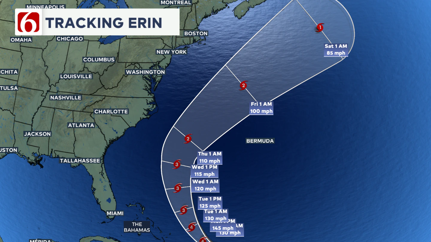
Later Monday afternoon, Erin is expected to shift directions closer to the north, eventually moving NE by Thursday afternoon. At this time, the storm is not expected to make landfall on the east coast, but will still but impactful.

East Coast Impacts
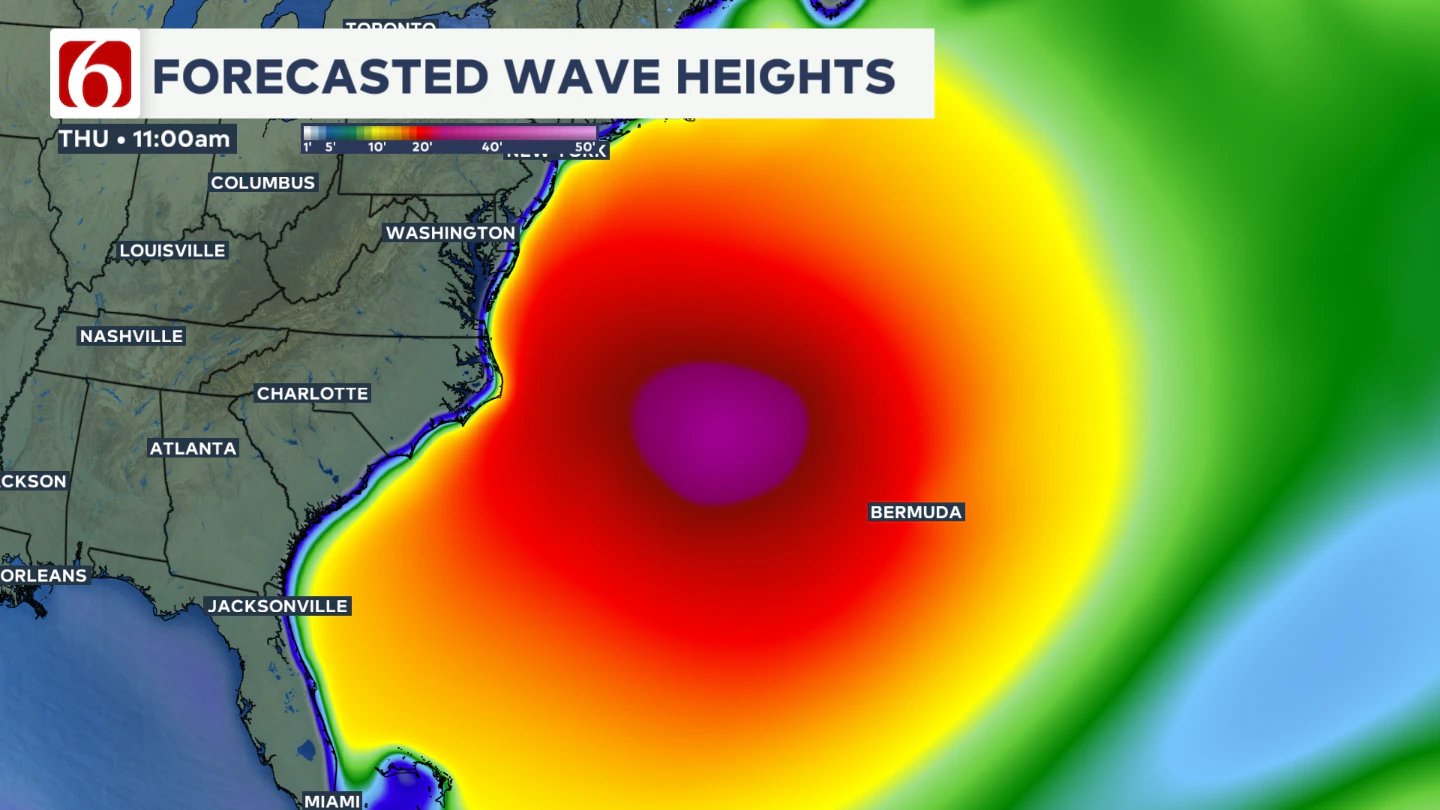
Although Hurricane Erin's eyewall will not make landfall in the U.S., the strength of the hurricane-force winds will impact wave heights along the outer banks of the Carolinas.
Wave heights up to 20' are possible along parts of the east coast by early Thursday.

Tropical Alerts
- A Tropical Storm Warning is in effect for Turks and Caicos Islands, Southeast Bahamas
- A Tropical Storm Watch is in effect for Central Bahamas
A Tropical Storm Warning means that tropical storm conditions are expected somewhere within the warning area.
A Tropical Storm Watch means that tropical storm conditions are possible within the watch area, in this case within 12 to 24 hours.


Alan Crone
An integral part of the News On 6 Weather Team since 2006, Alan Crone keeps Oklahomans safe and informed about morning weather each weekday on Six in the Morning. He’s always keeping an eye on the sky for both severe weather and just weather that’s going to make your day a bit more interesting.
More Like This
August 15th, 2025
September 4th, 2025
September 4th, 2025
September 4th, 2025
Top Headlines
September 4th, 2025
September 4th, 2025
September 4th, 2025
September 4th, 2025


