Weather Blog: Wet And Soggy Weekend On The Way
Oklahoma Weather Forecast: Bookmark this page and refresh it often for the latest forecast and daily updates.Friday, November 1st 2024, 5:38 am
TULSA, Okla. -
A chilly Friday morning is underway with temperatures in the upper 30s and lower 40s across northeastern Oklahoma.
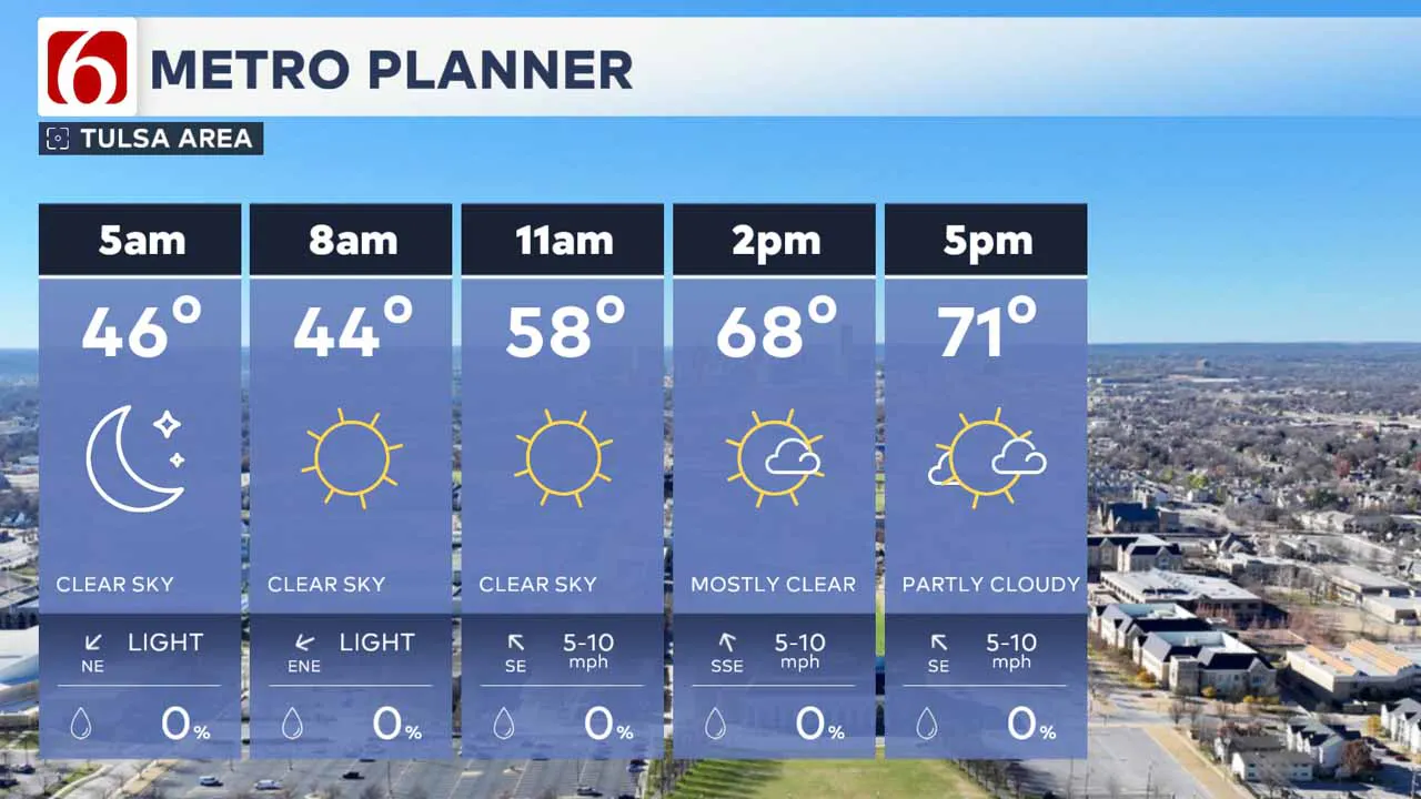 Mostly sunny skies will persist for most of the day before clouds arrive late this afternoon through tonight.
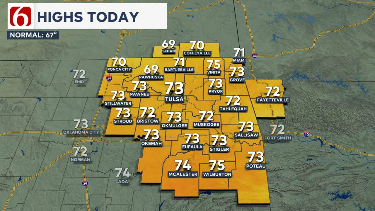
Afternoon highs should reach the lower 70s with a return of southeast winds at 10 to near 15 mph.
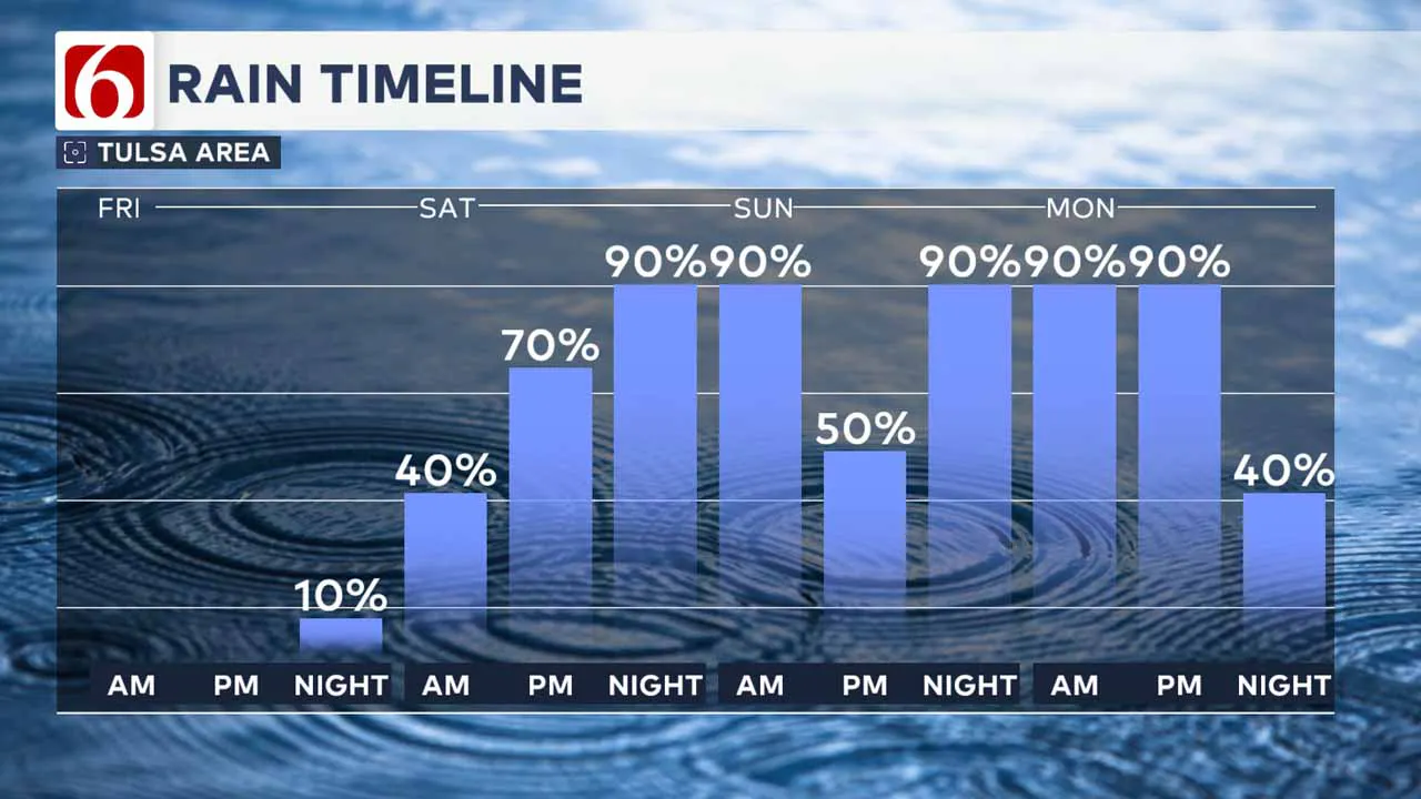
An unsettled weather pattern will continue tonight through the weekend, including early next week with additional showers and thunderstorm chances continuing into early next week.
Strong upper-level flow will approach the area this weekend, especially Sunday afternoon and Monday, presenting the potential for severe weather across central and eastern Oklahoma.
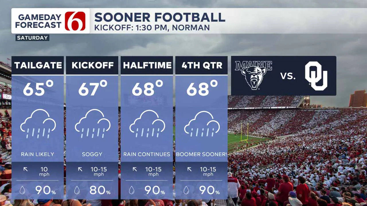
Beforehand, several rounds of showers and storms could lead to pockets of locally heavy rainfall for part of the weekend.
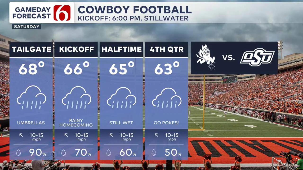
The main upper-level pattern keeps a long-wave trough across the western United States and will send several waves of instability at the base of the trough over Oklahoma.
The timing of these individual waves may change, but higher probabilities for showers will develop early Saturday morning to our west and then again late Saturday night into Sunday morning moving across eastern Oklahoma.
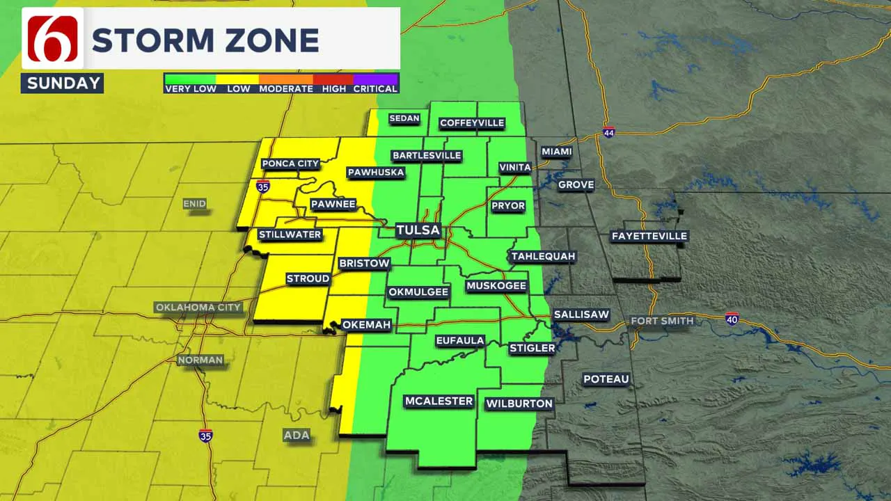
What is next week's forecast?
A third round would become more likely Sunday afternoon and evening as the parent trough approaches from the West.
A cold front associated with this system will finally clear the area late Monday afternoon and night with additional storms, including possible strong to severe threats before cooler and dry conditions arrive for Election Day.
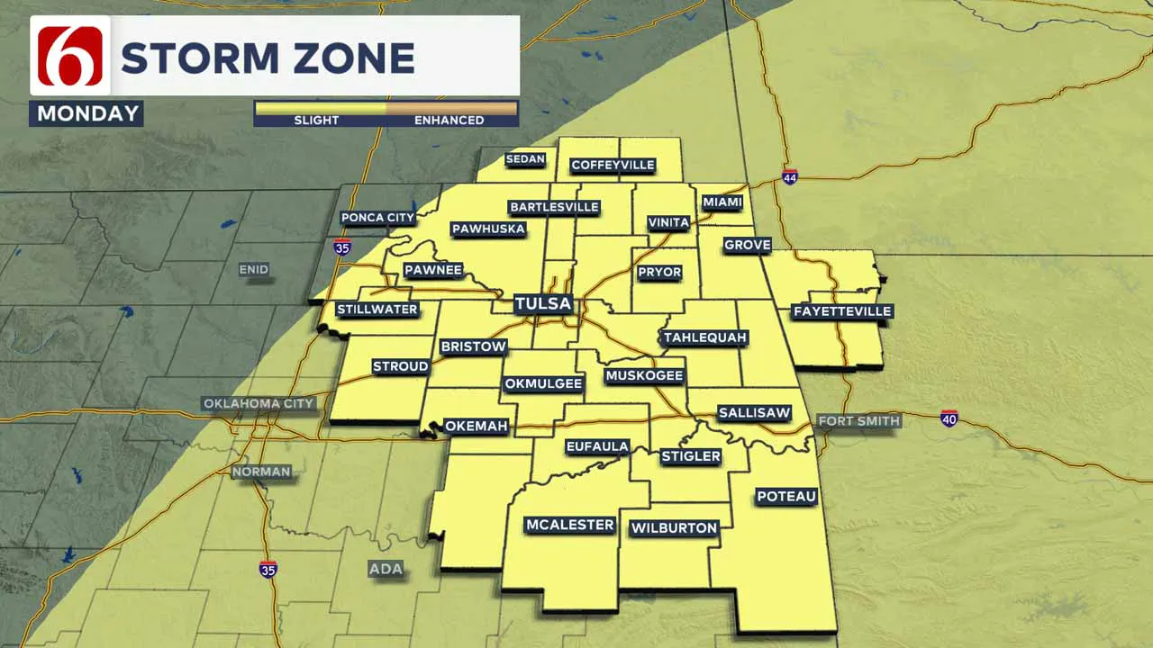
Tuesday features morning lows in the 50s and daytime highs in the 60s, with northwest winds at 10 to 20 and decreasing clouds.
The data differs regarding the next system late next week, but showers and some thunder should return by the second half of next week.
What are the major traffic projects around Tulsa this week?
The Oklahoma Department of Transportation (ODOT) and Oklahoma Turnpike Authority (OTA) provide daily details on several traffic advisories for the Tulsa area and surrounding regions.
To start October, here are some of the significant traffic advisories. For more information, see our detailed list.
I-244 Pavement Rehabilitation
- Ongoing pavement work between I-44 and the Arkansas River bridge, with lane and ramp closures lasting through spring 2025.
US-75 Bridge Rehabilitation
- Lane closures at 7th St. and off-ramp closures to 7th St. through fall 2024 for bridge rehabilitation.
US-412 Bridge Rehabilitation
- US-412 narrowed to two lanes at 81st W. Ave. in Sand Springs through February 2025.
Emergency Info: Outages Across Oklahoma:
Northeast Oklahoma has various power companies and electric cooperatives, many of which have overlapping areas of coverage. Below is a link to various outage maps.
Indian Electric Cooperative (IEC) Outage Map
Oklahoma Association of Electric Cooperatives Outage Map — (Note Several Smaller Co-ops Included)
The Alan Crone morning weather podcast link from Spotify:
https://open.spotify.com/show/0dCHRWMFjs4fEPKLqTLjvy
The Alan Crone morning weather podcast link from Apple:
Follow the News On 6 Meteorologists on Facebook!

More Like This
November 1st, 2024
November 1st, 2024
November 1st, 2024
Top Headlines
November 1st, 2024
November 1st, 2024


