Weather Blog: November Chill Returns For Thanksgiving Week
Oklahoma Weather Forecast: Bookmark this page and refresh it often for the latest forecast and daily updates.Monday, November 25th 2024, 7:06 am
TULSA, Okla. -
Chilly air is surging back into Green Country as a very, very busy holiday week begins!
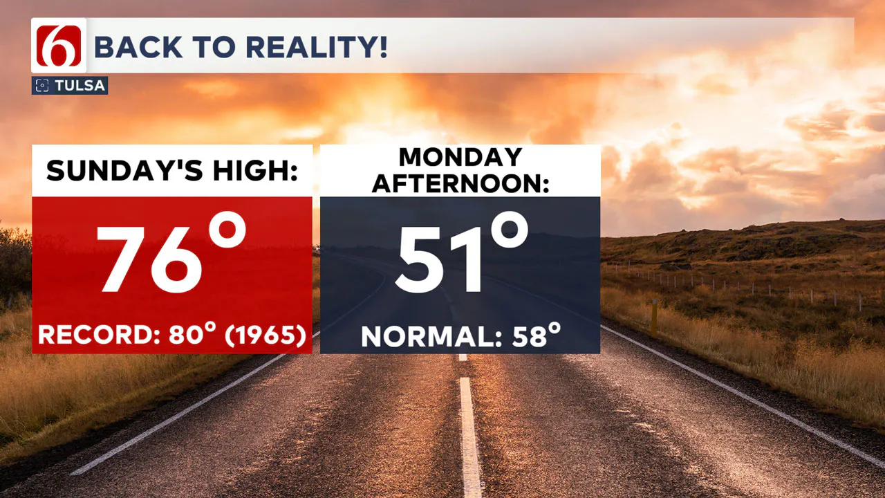
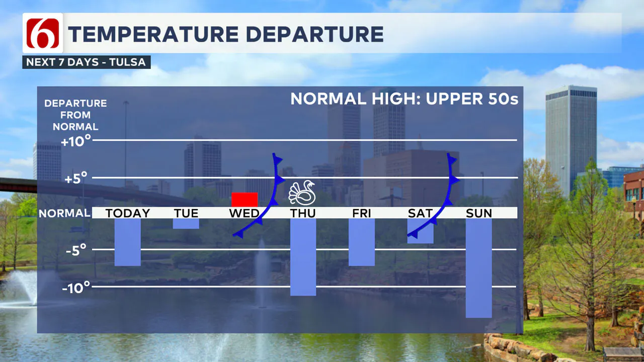
After near-record warmth and south winds on Sunday, a cold front is bringing much chillier temperatures and stiff north winds back into eastern Oklahoma for our Monday. Today’s cold front is the first of three cold fronts that will swing across Green Country this week!

Temperatures will hold in the 40s for much of our Monday, with some late-day sun breaks nudging us briefly into the lower 50s in the mid to late afternoon hours.
Tuesday will be a quieter day as high pressure settles in, with below-normal lows in the morning and highs in the 50s Tuesday afternoon.

By midday Wednesday, another stout cold front enters Oklahoma with temperatures falling in the late day hours. Wednesday’s cold front will come through primarily dry, with a very slight chance of a few light showers behind the front Wednesday night.
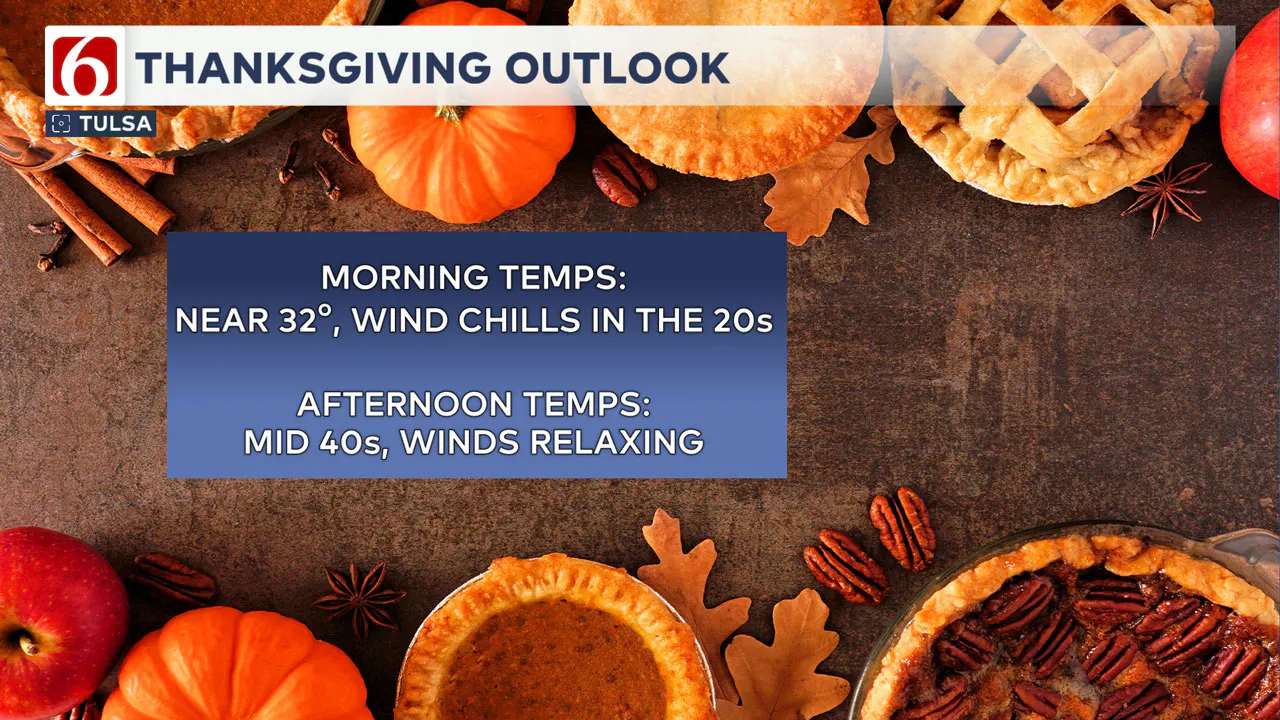
That Wednesday cold front will bring a holiday chill for Thanksgiving Thursday! North winds will be quite cold Thanksgiving morning but will thankfully settle down Thanksgiving afternoon. Plan for highs in the mid-40s on Thanksgiving!

Our third cold front of the week shows up on Saturday, with an even bigger chill for the tail end of the holiday weekend. But very little moisture is expected over the next several days.
Emergency Info: Outages Across Oklahoma:
Northeast Oklahoma has various power companies and electric cooperatives, many of which have overlapping areas of coverage. Below is a link to various outage maps.
Indian Electric Cooperative (IEC) Outage Map
Oklahoma Association of Electric Cooperatives Outage Map — (Note Several Smaller Co-ops Included)
The Alan Crone morning weather podcast link from Spotify:
https://open.spotify.com/show/0dCHRWMFjs4fEPKLqTLjvy
The Alan Crone morning weather podcast link from Apple:
Follow the News On 6 Meteorologists on Facebook!

More Like This
November 25th, 2024
November 25th, 2024
November 25th, 2024
November 25th, 2024
Top Headlines
November 25th, 2024
November 25th, 2024
November 25th, 2024


