Live Updates: Tornado Watch Expires For Tulsa; Still Active For Most Of Eastern Oklahoma
Oklahoma Weather Forecast: Bookmark this page and refresh it often for the latest forecast and daily updates.Wednesday, May 8th 2024, 7:18 pm


TULSA, Okla. -
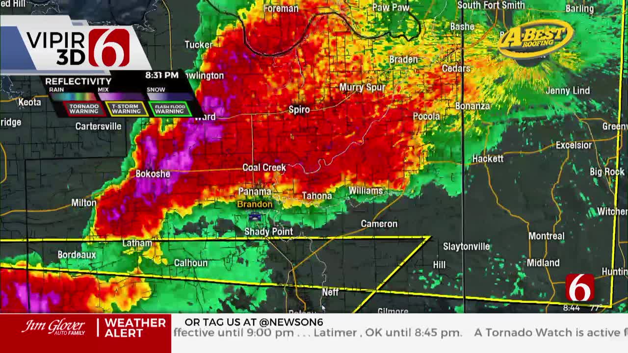
The threat of strong to severe storms is increasing for the southeastern parts of Oklahoma Wednesday.
These storms will move quickly and drift north toward the Arkansas border.

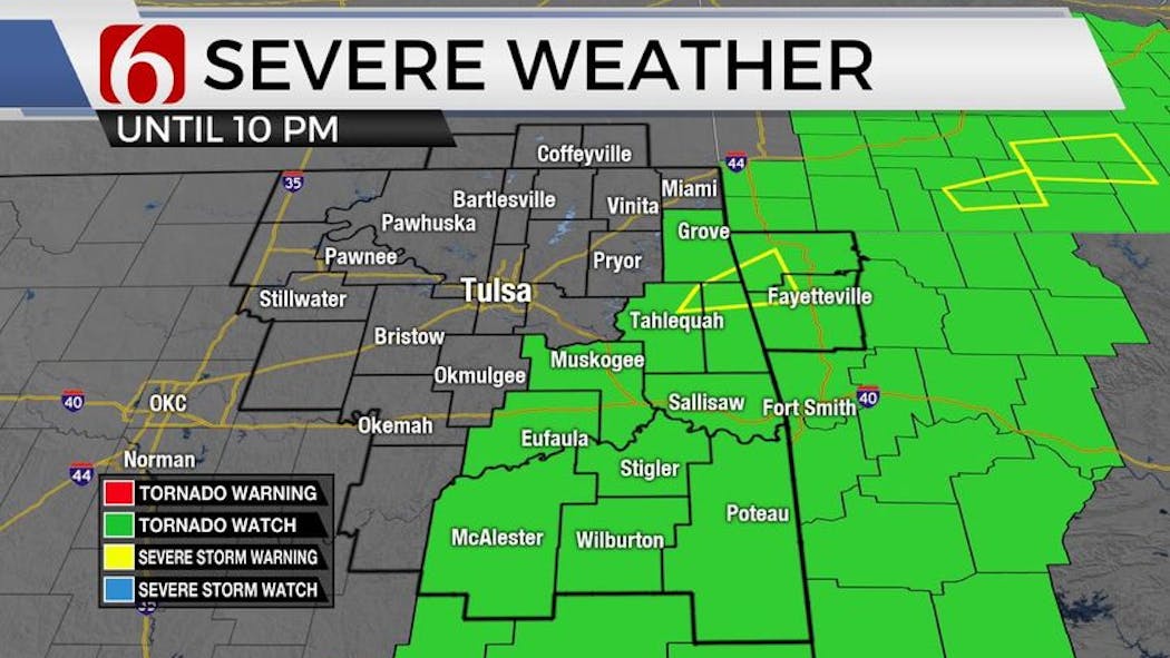
Active Watches & Warnings
- A Tornado Watch has been issued for Adair, Cherokee, Delaware, Haskell, Hughes, Latimer, Le Flore, McIntosh, Mayes, Muskogee, Okmulgee, Ottawa, Pittsburg, Pushmataha, Sequoyah, and Wagoner County until 10:00 p.m.
What are the storm chances Wednesday morning in Oklahoma?
This boundary should be near or north of the Highway 412 corridor over the next few hours. Strong forcing is evident early this morning moving across the central plains and brushing northern Oklahoma into southwestern Missouri. Additionally, a strong low-level jet is underway and will attempt to interact with an advancing warm front across the area.

Despite the early morning hours, due to the deep moisture near and south of this boundary and increasing instability, any storms that develop with the updraft on this front will be severe, including the potential for all modes of severe weather. This chance remains very low but not zero.

Updrafts that remain north of the front will tend to remain elevated producing large hail. This highly conditional threat is slightly higher and will remain for the next few hours this morning before the initial threat window moves from Southeastern Kansas into southwestern Missouri.
What are the chances for severe weather Wednesday afternoon and evening in Oklahoma?
From mid-morning to afternoon, a cold front begins moving southeast into the eastern third of the state and brings some additional threats for a few storms across far eastern to southeastern Oklahoma. This activity should be east of the metro.

A southwest wind by afternoon will tend to limit convergence along the boundary initially. The higher probability for these storms will be along or southeast of the Highway 69 corridor with the best chance across southeastern OK into western Arkansas.
All modes of severe weather will be possible but very large hail and damaging winds will be the primary concern. By late afternoon, drier air will move southeast into northern OK taking the threat of storms away from the state as the dry air continues moving southeast.
What will the weather be like this weekend in Oklahoma?
Once this front passes the area, we'll experience dry and pleasant weather through the end of the week including most of the weekend.

Cooler weather arrives following the frontal passage bringing lows in the upper 40s and lower 50s and highs in the mid to lower 70s Thursday and Friday. Weekend highs will also remain in the upper 70s to lower 80s.
A weak system may brush part of the area Monday with a few showers and storm chances arriving Sunday night into early next week. Another system is likely to impact the area by the latter half of next week.
Outages Across Oklahoma:
Northeast Oklahoma has various power companies and electric co-operatives, many with overlapping areas of coverage. Below is a link to various outage maps.
Indian Electric Cooperative (IEC) Outage Map
Oklahoma Association of Electric Cooperatives Outage Map - (Note Several Smaller Co-ops Included)
The Alan Crone morning weather podcast link from Spotify:
https://open.spotify.com/episode/5j0ovActG8BZCOTqZQzrfU
The Alan Crone morning weather podcast link from Apple:
https://podcasts.apple.com/us/podcast/weather-out-the-door/id1499556141?i=1000646589555
Follow the News On 6 Meteorologists on Facebook!

Get The Daily Update!
Be among the first to get breaking news, weather, and general news updates from News on 6 delivered right to your inbox!
More Like This

May 8th, 2024

May 8th, 2024

May 8th, 2024

Top Headlines
May 8th, 2024

May 8th, 2024
May 8th, 2024
May 8th, 2024
